Tuesday, December 22, 2015

Wahclella Falls

Wahclella Falls

Resources: Hike Info


An hour from downtown Portland is the trail head for Wahclella Falls. The Gorge that morning had descending fog which made the Gorge magical! There was a nice parking lot, but you will need a Northwest Forest Pass in order to park there.  

This hike is one mile there, one mile back with amazingly mossy trees and the water was turquoise blue.
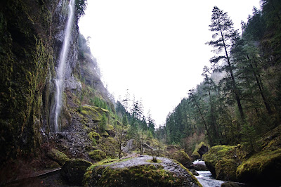
Near the beginning of the hike, there was this awesome waterfall RIGHT NEXT TO THE TRAIL! It had just rained about 3 inches the day before, so the water was gushing.


It was a super green/ lush hike with the fog rolling in lower and lower into the valley we were walking through. The fresh air of the forest really made the stress of finals just kind of melt away. It was exactly what I needed. 


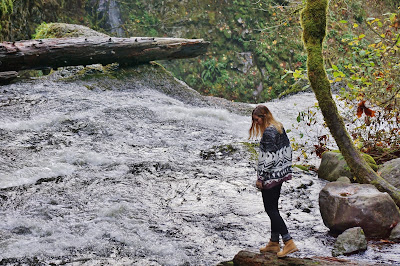
Towards the end of the trail, it splits off into two trails, both lead to the falls. The upper trail looks over the valley as you walk down, but the lower one, which we took, had amazing views of the valley on each side of the trail.

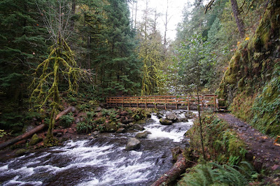
As you cross the bridge, you're greeted with a Yosemite-like view. Between the turqiouse blue crystal-clear water, the green foliage, and the majestic fog rolling it, it felt like walking through a national geographic photo!


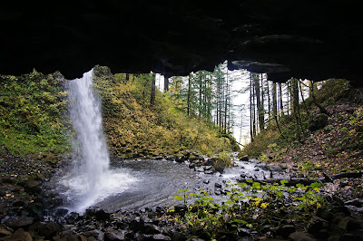
This was one of the most rewarding mile hikes I've ever done! You can walk right up to the falls, and the colors there were so vivid.


I was taking some shots of the waterfall, and as I turned around a massive animal came running down the hill at me! I realized it was the cutest dog I have ever seen! It came right up to me and gave me puppy kisses and let me rub her belly. I decided that once I get a yard, I will get myself a Malamute puppy to be my hiking companion.


This hike was definitely a 10/10. I also got some epic product shots for a couple companies out here. Next time a company wants an PNW inspired shot, Ill most likely come out here to do it. Check out more photos on my Instagram: @thecalifornianrefugee!

Wednesday, December 16, 2015

Triple Falls Hike

Triple Falls Hike

Resources
Hike info: http://www.oregonhikers.org/field_guide/Triple_Falls_Hike
Maps: http://columbiariverhighway.com/multnomah-wahkeena-falls-loop/

We started at the trail head near Horsetail Falls (get there early, limited parking). There's another hike in from a trail head closer to Oneonta Gorge, but with the Horsetail Falls entrance you pass Ponytail Falls (which you definitely want to see).

This hike was done a couple weeks ago while the gorge still had some fall color. Everything was yellow or green! The hike up to Ponytail Falls was about .4 miles in and at about 75 ft tall, the waterfall has a cavern you walk in to continue up the trail.


One of the small things I love about Oregon is how many dogs you see on the hikes! I always have an urge to pet them all and usually their owners are nice enough to strike up a conversation with while I play with the dog. I saw this corgi on the trail and I HAD to stop and pet him! The owners said that they bring him on all their hikes and he keeps up even with his little short legs!

We came across the bridge which looked sturdy however this sign was left on the side of it. it says "Attention Hikers: Due to damage sustained by this bridge, engineers have determined that it is safe  for only one person at a time to cross." Upon hearing this, Dylan proceeded to jump on it, causing me to slightly freak out. I had posted this picture on Instagram and people were saying that the sign had been there for months and months, For as popular as this hike is, it's shocking that they haven't fixed it yet.

Once you got past this bridge, the trail began to get continuously steep, however every switchback presented a view that overlooked the forest spotted with fall colors. The colors were unreal! I kept stopping and taking photos while yelling "OMG ITS BEAUTIFUL!" every five minutes. It probably took us double the amount of time it normally would to get there because I kept stopping, my boyfriend was not impressed. 


The pictures make the falls look smaller than they really are. The falls stand at about 85 feet tall. You look down on them and I looked, but there is no way to get to the bottom of the falls unless you have some kind of rock climbing gear.

Walk past the falls and there is a bridge maybe .2 miles down the trail. This continues on to the Larch Mountain trail.


I loved this hike! It was stated as moderated on the Oregon hikers website, which I think was a good description. I saw dogs, kids, and people of all ages on trail. The views were wonderful and the hike was decently maintained. Check out my Instagram for more from the PNW @thecalifornianrefugee!

Tuesday, December 15, 2015

Panther Creek Falls

Panther Creek Falls


Resources:


This day trip was definitely an adventurous one. My friend from Southern California was visiting, and we wanted to go find these falls which are about 1.5 hours from downtown Portland. My trusty minivan just had it’s rack and pinion replaced (not cheap) and I thought it would be ready to go for a trip. Well, 20 minutes into the drive, the radiator began to overheat. “We could stop every few minutes and let the engine cool.” I thought. “Hell no, I'm not going to put up with that. Should we rent a Car2Go? Possibly, it’s $60 for a day. How about a car rental from the airport?” I made a few calls and it was only $30 to rent a sweet little car for the day! So we stashed the minivan in a neighborhood close to PDX and picked up the rental car to finally begin the journey.


As we drove through the Columbia River Gorge, we noticed it was completely filled with smoke! There had been a couple fires nearby in Washington. Earlier, I had looked up a map of the local fires to see if they were close, and they didn't look close to the falls, but I was beginning to second guess myself. As we drove across the Bridge of Gods, the smoke got thicker. I was worried we would get close to the falls and then get turned around and sent home due to the fires.
Wild Turkeys in smokey Washington
If you type into your GPS "Panther Creek Falls" it will get you to this general area. There is a gravel parking lot which you will need a Northwest Forest Pass to park. Because we had taken the rental, I did not have my pass, so we just chanced it. There's a trail across the road from the parking area that leads to the view looking over the falls. Very short hike, not too steep of an incline, and it has a great view of the falls.
View above the falls.


Creek that led into the near side of the falls.
The view was pretty, but this did not satisfy us completely. We wanted to be right at the base. I've seen pictures from below, I knew it was possible to get down there, but I wasn't sure how. We walked back up to the road and walked down the way we had come a bit. There was a very tiny trail and we weren't sure where it led, but we decided to take it. There were parts that we had to slide down a dirt incline on our butts, hold on to vines, and there were parts that were a bit slippery. It was not easy and I was wearing flip flops (left my hiking shoes in my car) and my feet ended up very dirty. THIS TRAIL LED TO THE BASE!
Trail down to base of falls.
The falls were magnificent from the bottom! It was sooo worth the scramble down! We stared at these falls for about 40 minutes in awe with how pretty it was.


Panther Creek Falls from base
Looking downstream from the falls, the view was almost just as pretty. These PNW forests are so luscious and green!
Downstream View


Scale of Falls next to Michelle


Trail from base to parking
We hiked back up using roots to pull ourselves up the trail back to the lot. We were pleased to see no ticket on the windshield (get a pass though). Once we got near the airport, we filled up the tank and 3 hours of driving in this car amounted to ONLY 10$! With the car rental, and the gas, (total 40$) the same amount would have been spent on my car for gas! That's a bit of an exaggeration, but it was great having a cute little car to drive around in.